1 of 4

"Leslie MacDonald ""Max"" Gill"
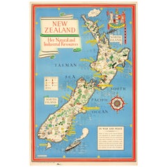
Original WWII Map Of New Zealand - Natural & Industrial Resources In War & Peace

1943

$3,118.87List Price

You May Also Like

Original WWII Map of New Zealand - Natural & Industrial Resources in War & Peace

Original WWII Map of New Zealand - Natural & Industrial Resources in War & Peace

By "Leslie MacDonald ""Max"" Gill"

Located in London, GB

Original vintage World War Two pictorial map for New Zealand her natural and Industrial resources featuring a great illustration by the notable graphic designer, cartographer and artist MacDonald Gill (Leslie MacDonald Gill aka Max Gill...

Category

Vintage 1940s British Posters

Materials

Paper
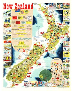
Original New Zealand vintage poster Map and Activities

Original New Zealand vintage poster Map and Activities

Located in Spokane, WA

Original vintage 1962 linen-backed map of New Zealand in very fine condition, ready to frame. Grade A- with only small edge tears from linen backing. No paper loss. Excellent colors....

Category

1960s American Realist Landscape Prints

Materials

Lithograph

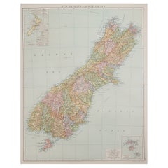
Large Original Vintage Map of New Zealand, South Island, circa 1920

Large Original Vintage Map of New Zealand, South Island, circa 1920

Located in St Annes, Lancashire

Great map of South Island, New Zealand Original color. Good condition / repair to a minor tear on right edge Published by Alexander Gross Unframed.

Category

Vintage 1920s English Edwardian Maps

Materials

Paper

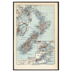
Antique Map of New Zealand, 1895

Antique Map of New Zealand, 1895

$114Sale Price|20% Off

H 9.65 in W 6.3 in D 0 in

Antique Map of New Zealand, 1895

Located in Langweer, NL

Antique map titled 'Neu-Seeland.' Map of New Zealand. With inset maps of the large cities. This attractive original old antique print / plate / map ...

Category

Antique 19th Century Maps

Materials

Paper

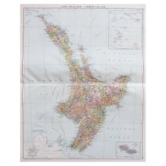
Large Original Vintage Map of New Zealand, North Island, circa 1920

Large Original Vintage Map of New Zealand, North Island, circa 1920

Located in St Annes, Lancashire

Great map of North Island, New Zealand Original color. Good condition / minor foxing to right edge Published by Alexander Gross Unframed.

Category

Vintage 1920s English Edwardian Maps

Materials

Paper

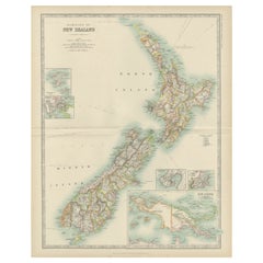
Antique Map of New Zealand by Johnston '1909'

Antique Map of New Zealand by Johnston '1909'

$332Sale Price|20% Off

H 19.49 in W 24.41 in D 0.02 in

Antique Map of New Zealand by Johnston '1909'

Located in Langweer, NL

Antique map titled 'New Zealand'. Original antique map of New Zealand. With inset maps of Chatham, Auckland, Wellington, Dunedin, and New Gu...

Category

Early 20th Century Maps

Materials

Paper

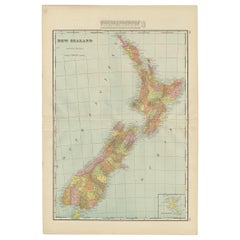
Antique Map of New Zealand by G.F. Cram, 'circa 1906'

Antique Map of New Zealand by G.F. Cram, 'circa 1906'

Located in Langweer, NL

Antique map titled 'New Zealand'. Large map of New Zealand with a small legend of the Chatham Islands. On the verso, a map of the North Polar regions and a map of Tasmania can be fou...

Category

20th Century Maps

Materials

Paper

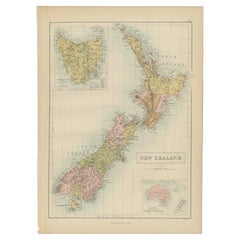
Antique Map of New Zealand by A & C. Black, 1870

Antique Map of New Zealand by A & C. Black, 1870

$166Sale Price|20% Off

H 17.52 in W 13 in D 0.02 in

Antique Map of New Zealand by A & C. Black, 1870

Located in Langweer, NL

Antique map titled 'New Zealand'. Original antique map of New Zealand with inset Maps of Australia, New Zealand and Tasmania. This map origi...

Category

Antique Late 19th Century Maps

Materials

Paper

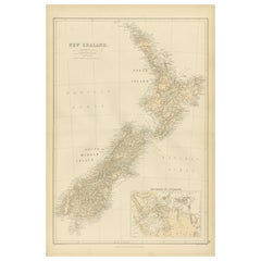
1882 Original Antique Map of New Zealand with Inset of Auckland's Environs

1882 Original Antique Map of New Zealand with Inset of Auckland's Environs

Located in Langweer, NL

1882 Original Antique Map of New Zealand with Inset of Auckland's Environs This 1882 map of New Zealand, published by Blackie and Son as part of the 'Comprehensive Atlas and Geograp...

Category

Antique 1880s British Maps

Materials

Paper

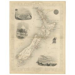
Map of New Zealand Showing Maori Culture and Early Colonial Settlements, 1851

Map of New Zealand Showing Maori Culture and Early Colonial Settlements, 1851

Located in Langweer, NL

John Tallis & Company were renowned for their ornate and detailed maps in the mid-19th century. Their works often featured elaborate borders, decorative motifs, and insets of vignett...

Category

Antique 1850s Maps

Materials

Paper