Want more images or videos?
Request additional images or videos from the seller
1 of 9

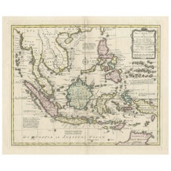
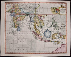
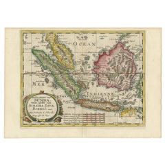
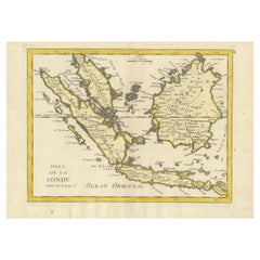
Antique Map of the Sunda Islands Sumatra, Java, Malay Peninsula & Borneo (1739)

$636.92
£470.57
€539.02VAT Included
CA$886.11
A$888.68
CHF 515.56
MX$10,849.62
NOK 5,971.60
SEK 6,111.53
DKK 4,110.28

About the Item

Antique map titled 'Nieuwe kaart van de Sundasche Eilanden als Borneo, Sumatra en Groot Iava & c'. Detailed map of the Sunda Islands, Southeast Asia, extending from the tip of Cambodia to Java. This map originates from: 'Hedendaagsche Historie, of tegenwoordige staat van alle volkeren... II deel...', published by Isaak Tirion, Amsterdam, 1739 ed. (originally published 1730). This is in fact an amended Dutch edition of: 'Modern History: or the Present State of all Nations.', published by Thomas Salmon since 1725. German, Italian and Dutch editions were published as well. This monumental Dutch edition, translated by M. van Gogh and published by Isaac Tirion, was much amended and enlarged into a 39 volume series. This plate originates from the second volume from this series which deals with: Java, Sumatra, Siam, Kochin and Tonkin.
  • Creator:
    Isaak Tirion (Artist)
  • Dimensions:
    Height: 12.21 in (31 cm)Width: 15.56 in (39.5 cm)Depth: 0.02 in (0.5 mm)
  • Materials and Techniques:
  • Period:
  • Date of Manufacture:
    1739
  • Condition:
    Please study image carefully.
  • Seller Location:
    Langweer, NL
  • Reference Number:
    Seller: BG-040501stDibs: LU305439548553

More From This Seller

View All
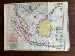
Antique Map of the Sunda Islands Including Sumatra, Java, and Borneo, 1705

Antique Map of the Sunda Islands Including Sumatra, Java, and Borneo, 1705

Located in Langweer, NL

Title: “Antique Map of the Sunda Islands Including Sumatra, Java, and Borneo” This print is a beautifully detailed and relatively rare map of Western Indonesia, encompassing the reg...

Category

Antique Early 1700s Maps

Materials

Paper
Old Original Antique Map of the Sunda Islands of Indonesia, 1756

Old Original Antique Map of the Sunda Islands of Indonesia, 1756

Located in Langweer, NL

Title: Isles De La Sonde. Attractive old decorative map of the Isles de la Sonde, Borneo, Sumatra, Java and Malacca ( Malaysia) with the Straits of Malacca. Penang is spelled as P...

Category

Antique 1750s French Maps

Materials

Paper

Original Map of the East Indies Including Sumatra, Java, Borneo & Malaysia, 1755

Original Map of the East Indies Including Sumatra, Java, Borneo & Malaysia, 1755

Located in Langweer, NL

TitlEast Indies map – Java, Sumatra, Borneo & Malay Peninsula, c.1755 Attractive 18th-century map of the East Indies centered on Borneo and the Malay world, showing Sumatra, Java, t...

Category

Antique 1750s Dutch Maps

Materials

Paper

Old Map Covering All of Southeast Asia from Persia to the Timor Island, 1712

Old Map Covering All of Southeast Asia from Persia to the Timor Island, 1712

Located in Langweer, NL

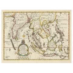
Description: Antique map titled 'A New Map of the East Indies'. Old map covering all of Southeast Asia from Persia to the Timor Island, inclusive of the modern day nations of India, ...

Category

Antique 1710s French Maps

Materials

Paper

Original Antique Map of the Philippines, Malaysia, Indonesia, Singapore, c.1690

Original Antique Map of the Philippines, Malaysia, Indonesia, Singapore, c.1690

Located in Langweer, NL

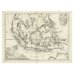
Antique map titled 'Isole dell' Indie, diuise in Filippine, Molucche e della Sonda'. Old map of the Philippines, Malaysia, Indonesia, Singapore, Northern Australia and contiguous i...

Category

Antique 1690s Italian Maps

Materials

Paper

You May Also Like

Original Antique Map of South East Asia by Thomas Clerk, 1817

Original Antique Map of South East Asia by Thomas Clerk, 1817

Located in St Annes, Lancashire

Great map of South East Asia Copper-plate engraving Drawn and engraved by Thomas Clerk, Edinburgh. Published by Mackenzie And Dent, 1817 Unframed.

Category

Antique 1810s English Maps

Materials

Paper

Antique French Map of Asia Including China Indoneseia India, 1783

Antique French Map of Asia Including China Indoneseia India, 1783

Located in Amsterdam, Noord Holland

Very nice map of Asia. 1783 Dedie au Roy. Additional information: Country of Manufacturing: Europe Period: 18th century Qing (1661 - 1912) Condition: Overall Condition B (Good Used)...

Category

Antique 18th Century European Maps

Materials

Paper

Antique 1803 Italian Map of Asia Including China Indoneseia India

Antique 1803 Italian Map of Asia Including China Indoneseia India

Located in Amsterdam, Noord Holland

Antique 1803 Italian Map of Asia Including China Indoneseia India Very nice map of Asia. 1803. Additional information: Type: Map Country of Manufacturing: Europe Period: 19th centu...

Category

Antique 19th Century European Maps

Materials

Paper

Southern Greece: A Large 17th C. Hand-colored Map by Sanson and Jaillot

Southern Greece: A Large 17th C. Hand-colored Map by Sanson and Jaillot

By Nicolas Sanson

Located in Alamo, CA

This large original hand-colored copperplate engraved map of southern Greece and the Pelopponese Peninsula entitled "La Moree Et Les Isles De Zante, Cefalonie, Ste. Marie, Cerigo & C...

Category

Antique 1690s French Maps

Materials

Paper

Tabula Indiae Orientalis - Etching by Frederick de Wit - 1680ca

Tabula Indiae Orientalis - Etching by Frederick de Wit - 1680ca

By Frederick de Wit

Located in Roma, IT

This double-page etching with contemporary coloring, entitled Tabula Indiae orientalis, was realized by the cartographer Frederick de Wit for the famous Atlas published in Amsterdam ...

Category

1680s Modern Figurative Prints

Materials

Etching