Want more images or videos?
Request additional images or videos from the seller
1 of 6

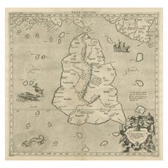
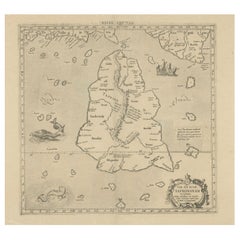
Antique Ptolemaic Map of Ceylon or nowadays Sri Lanka

Price:$615.08
$652.94List Price

You May Also Like

More From This Seller

View All
Rare Original Antique Ptolemy Map of Ceylon, Present Day Sri Lanka

Rare Original Antique Ptolemy Map of Ceylon, Present Day Sri Lanka

Located in Langweer, NL

Original antique map titled 'Tab XII Asiae Taprobanam (..)'. For this map of Toprobana (Sri Lanka), Ptolemy drew on the accounts of travelers and sailors and though the information was secondhand and often inaccurate, it represented the most advanced account of the world's geography at that time. This map depicts the island with the typical misconceptions of the period with the enlarged island straddling the Equator and nearly divided by a ridge of mountains. A small part of India is incorrectly shown in the northeast corner of the map and a spurious coastline labeled Gangem fills the upper right corner. The stipple engraved sea contains an oriental ship...

Category

Antique Late 17th Century Maps

Materials

Paper

Mercator's Ptolemaic map of Taprobana, (Ceylon) Sri Lanka

Mercator's Ptolemaic map of Taprobana, (Ceylon) Sri Lanka

Located in Langweer, NL

Antique map titled 'Asiae XII Tab'. Mercator's Ptolemaic map of Taprobana. The map shows Ptolemy's erroneous location of the island of Sri Lanka near the equator, with a bit of India...

Category

Antique 16th Century Maps

Materials

Paper

Large Antique Map of Ceylon, Sri Lanka

Large Antique Map of Ceylon, Sri Lanka

Located in Langweer, NL

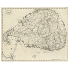
Antique map titled 'Nieuwe Kaart van het Eyland Ceylon opgestelt door Francois Valentyn'. Beautiful map of Sri Lanka. Originates from 'Oud en Nieuw Oost ...

Category

Antique Mid-18th Century Maps

Materials

Paper

1638 Plancius Detailed Map of Sri Lanka or Ceylon with Decorative Cartouches

1638 Plancius Detailed Map of Sri Lanka or Ceylon with Decorative Cartouches

Located in Langweer, NL

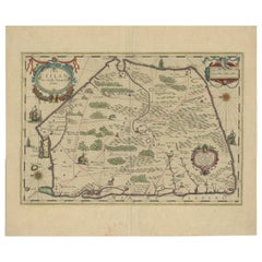
"1638 Plancius Detailed Map of Sri Lanka with Decorative Cartouches" This beautifully detailed map of Sri Lanka, titled "Ins. Ceilan," was engraved by P. Plancius from a design by C...

Category

Antique 1630s Maps

Materials

Paper

Antique Map extending from the Spice Islands to the west of Papua New Guinea

Antique Map extending from the Spice Islands to the west of Papua New Guinea

Located in Langweer, NL

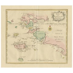
Antique map titled 'Kaart van de Papoasche Eilanden'. Beautiful original old map extending from the Spice Islands (Sallawatty, Patenta, Gammen, Land van Waigeeuw, Popo, Misool, and part of Seram) to the western end of Papua New Guinea. Many smaller islands are detailed, and depth soundings are shown near Seram and to the east of Misool. This map originates from 'Nieuwe en Beknopte Hand-Atlas, bestaande in eene Verzameling van eenige der algemeenste en nodigste Landkaarten' by I. Tirion. Published circa 1770. Tirion was born in Utrecht in 1705. He moved to Amsterdam in 1725 and set up shop on Damrak as a book publisher. Tirion quick rose in prominence by publishing pamphlets, historical works, and, most importantly...

Category

Antique Late 18th Century Maps

Materials

Paper

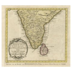
Original Antique Map of Southern India and Ceylon 'Present-Day Sri Lanka'

Original Antique Map of Southern India and Ceylon 'Present-Day Sri Lanka'

By Jakob van der Schley

Located in Langweer, NL

Antique map titled 'Suite de la Carte de l'Indoustan (..) - Vervolg van de Kaart van Hindoestan (..)'. Original antique map of Southern India and Ceylon (present-day Sri Lanka). This...

Category

Antique Mid-18th Century Maps

Materials

Paper