Want more images or videos?
Request additional images or videos from the seller
1 of 8

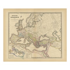
Imperium Romanum: A Detailed Map of the Roman Empire in its Zenith, 1880

Price:$237.11
$350.92List Price

You May Also Like

More From This Seller

View All
Roman Italy and Provinces: A Cartographic Snapshot, 1880

Roman Italy and Provinces: A Cartographic Snapshot, 1880

Located in Langweer, NL

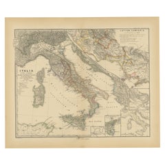
The map titled "ITALIA, Gallia Cisalpina, Sicilia, Sardinia, Corsica" focuses on Italy and its surrounding regions during Roman times. It offers a detailed depiction of the Italian peninsula, the Po Valley (Gallia Cisalpina), and the islands of Sicily, Sardinia, and Corsica. Produced as part of the "Spruner-Menke Atlas Antiquus" by Karl Spruner von Merz and edited by Theodorus Menke, this map reflects the 19th-century European scholarship on ancient geography and history. The period represented is likely during the Roman Republic or early Roman Empire, suggested by the level of detail in regions like Latium and Campania, which were central to Roman culture and power. This era was marked by Roman expansion and consolidation of the Italian peninsula, as well as the Punic Wars, which led to Roman dominance over the Mediterranean. What makes this map interesting is its: 1. **Rich Detail**: The map delineates the intricate network of Roman roads, cities, and colonies, showing the infrastructure that facilitated Roman administration and control. 2. **Strategic Locations**: It identifies strategic locations like harbors and passes, crucial for trade and military campaigns. 3. **Geographic Accuracy**: It reflects the geographical knowledge of the time, with an accurate representation of the topography that shaped the development of these regions. 4. **Cultural and Historical Sites**: Insets of important sites like Syracuse offer a closer look at places of historical significance. 5. **Educational Purpose**: The map was designed to aid in the study of Roman history, providing a visual tool for understanding the ancient world...

Category

Antique 1880s Maps
Materials

Paper

Antique Map of Part of the Roman Empire by H. Kiepert, circa 1870

Antique Map of Part of the Roman Empire by H. Kiepert, circa 1870

By Heinrich Kiepert

Located in Langweer, NL

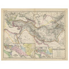
Antique map titled 'Imperia Persarum et Macedonum'. Depicts part of the Roman Empire, from Greece to Eastern India. This map originates from 'Atlas Antiqus. Zwölf Karten zur Alten Ge...

Category

Antique Late 19th Century Maps

Materials

Paper

Asia Minor and Provinces: A Roman Empire Map from Spruner-Menke Atlas, 1880

Asia Minor and Provinces: A Roman Empire Map from Spruner-Menke Atlas, 1880

Located in Langweer, NL

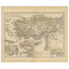
This authentic map of the 19th century, titled "PONTUS ET BITHYNIA, ASIA, LYCIA ET PAMPHYLIA, GALATIA, CAPPADOCIA, SYRIA, CRET, CYPRVS," details the regions of Asia Minor and surrounding territories during the Roman Empire. The map is interesting for a number of reasons: 1. **Comprehensive Detail**: It covers a wide range of regions that played significant roles in ancient history, from the cultural crossroads of Asia Minor to the strategic island of Cyprus. 2. **Geographical Information**: It includes detailed topographical features such as mountain ranges, river systems, and coastlines, illustrating the complex geography that influenced ancient political and military strategies. 3. **Historical Context**: The map reflects the Roman administrative organization of these provinces, which were critical for trade, military campaigns, and cultural exchange within the empire. 4. **Inset Maps**: The presence of inset maps for Lycia, Ionia, and Asia Minor provides focused details on regions that had substantial historical significance due to their cultural heritage and geopolitical importance. 5. **Latin Labels**: The use of Latin in the map’s labels and descriptions adds to the historical authenticity and would have served as a scholarly reference for 19th-century academics. 6. **Ancient Civilizations**: This area was the cradle of numerous ancient civilizations and the map likely includes cities of ancient Greek...

Category

Antique 1880s Maps

Materials

Paper

Mediterranean, Black Sea & Ottoman Empire Map 1853

Mediterranean, Black Sea & Ottoman Empire Map 1853

Located in Langweer, NL

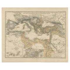
Mediterranean, Black Sea & Ottoman Empire Map 1853 This impressive antique print shows the Mediterranean and Black Sea regions with a focus on the Ottoman Empire, titled “Das Mittel...

Category

Antique Mid-19th Century German Maps

Materials

Paper

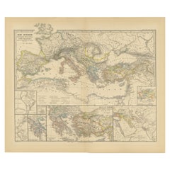
Mediterranean Encounters: From the Punic Wars to the Hannibalic War,  1880

Mediterranean Encounters: From the Punic Wars to the Hannibalic War, 1880

Located in Langweer, NL

The map, with the title "MARE INTERNUM cum populis adiacentibus a bello Hannibalico usque ad Vespasiani M. princip," depicts the Mediterranean Sea and its surrounding territories, ex...

Category

Antique 1880s Maps

Materials

Paper