Want more images or videos?
Request additional images or videos from the seller
1 of 9

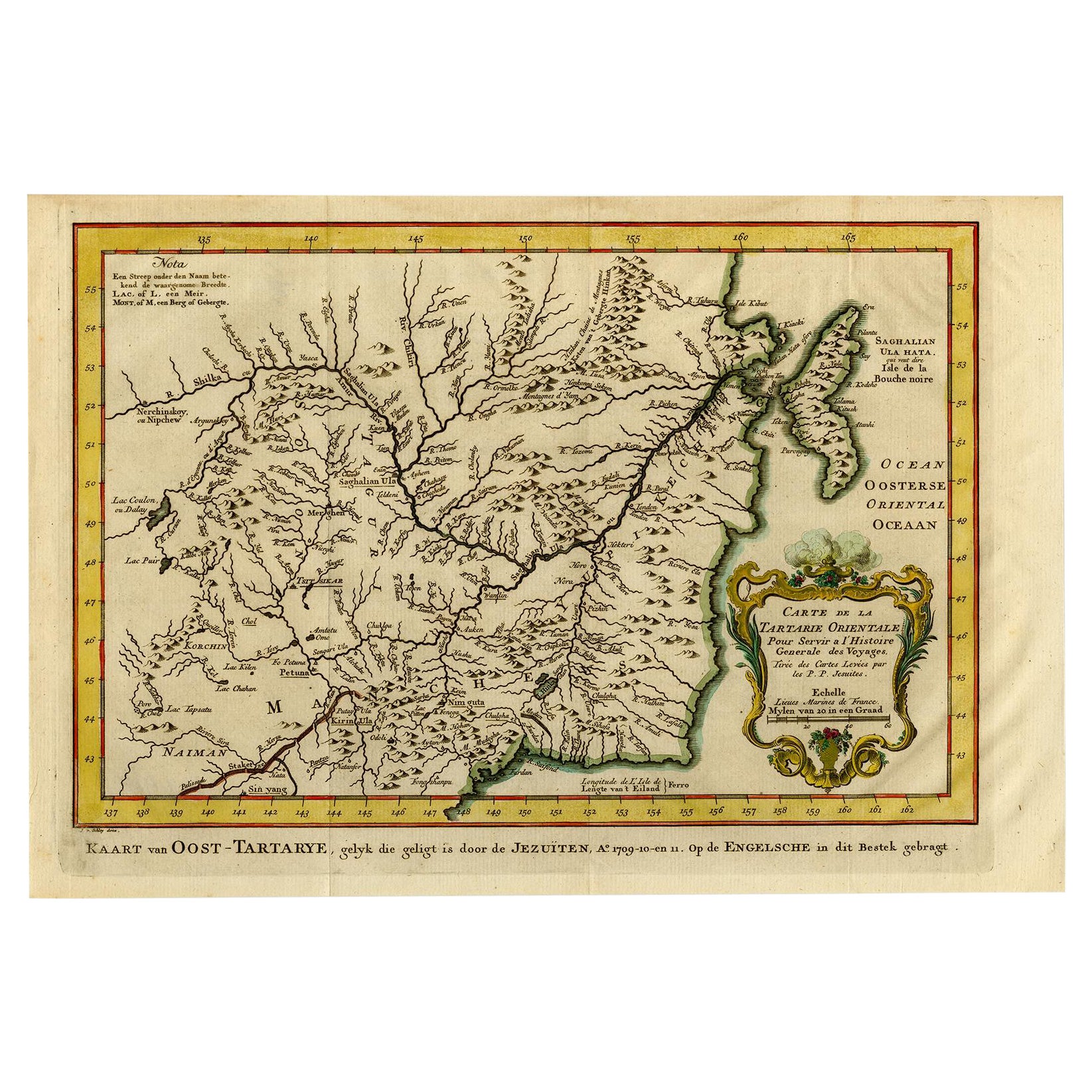
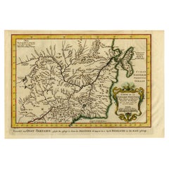
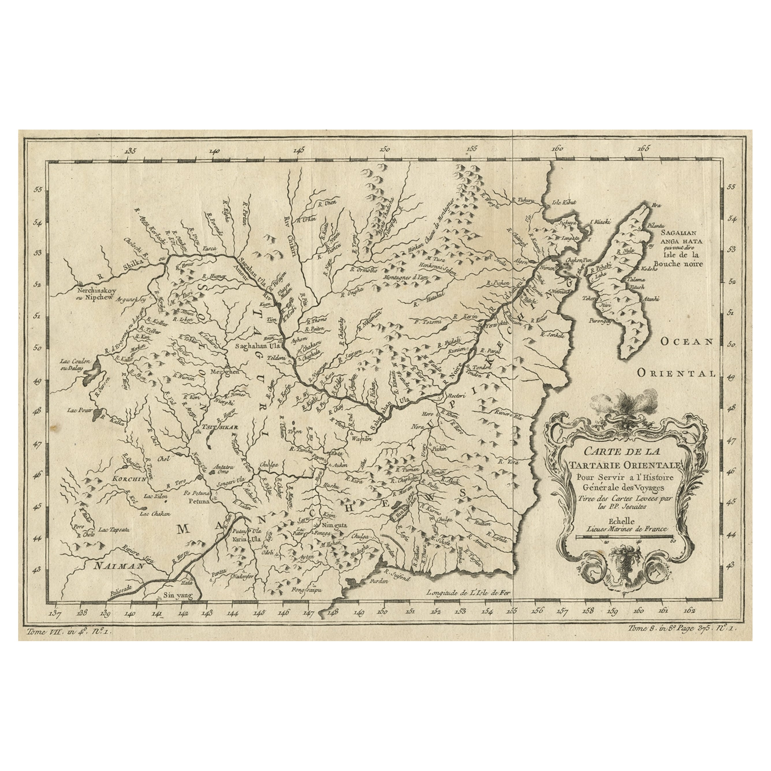
Antique Map of Manchuria & Eastern Tartary – Bellin, 1757

$272.49
£201.59
€230VAT Included
CA$377.14
A$378.46
CHF 220.72
MX$4,601.56
NOK 2,536.29
SEK 2,608.44
DKK 1,753.76

About the Item

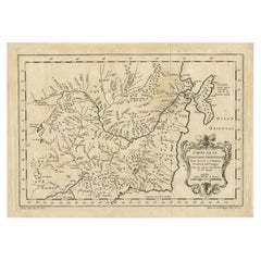
Antique Map of Manchuria & Eastern Tartary – Bellin, 1757 Antique engraved map titled “Carte de la Tartarie Orientale,” depicting Manchuria and the northeastern portion of Tartary in remarkable detail. The map covers the river systems, mountain ranges, and coastal regions of northeastern Asia, including areas along the Amur River basin and the Pacific coast, with references such as Sagallan Anga Hata and the Isle de la Bouche Noire. The Ocean Oriental (Pacific Ocean) is shown to the east, situating the region within its broader maritime context. The geography is rendered with Bellin’s characteristic clarity, showing a dense network of rivers, tributaries, and mountain chains that reflect eighteenth-century European knowledge of this strategically important and still relatively little-known region. The map includes a finely engraved decorative title cartouche, adding visual refinement while underscoring its intended role within a major scholarly publication. This map was produced by Jacques-Nicolas Bellin for L'Histoire Générale des Voyages, the influential travel compendium edited by Antoine François Prévost. Published circa 1757, the work aimed to compile the most authoritative geographic and ethnographic knowledge available, and Bellin’s maps formed its cartographic backbone. Bellin was one of the most important mapmakers of the eighteenth century. Appointed Hydrographer to the French Navy at a remarkably young age, he later became the first Ingénieur de la Marine at the Dépôt des cartes et plans de la Marine and Official Hydrographer to the French King. His maps are valued for their precision, restrained elegance, and scientific approach, qualities that are clearly evident in this sheet. A historically significant and visually appealing map, ideal for collectors of Asian cartography, early exploration, and eighteenth-century French engraving, as well as for interior settings seeking a refined and intellectual focal piece. Condition Good original condition with light age-related toning and minor handling wear consistent with mid-eighteenth-century engraved maps. Central fold as issued. No later coloring or restoration observed. Framing tips This map frames beautifully in a dark walnut or ebonized frame with a wide ivory or soft off-white mat. The decorative cartouche benefits from generous spacing, and museum glass is recommended to preserve the fine engraved detail. Technique: Engraving Maker: Jacques-Nicolas Bellin, France, circa 1757
  • Dimensions:
    Height: 9.85 in (25 cm)Width: 14.73 in (37.4 cm)Depth: 0.02 in (0.5 mm)
  • Materials and Techniques:
  • Period:
  • Date of Manufacture:
    1757
  • Condition:
    Good original condition with light age-related toning and minor handling wear consistent with mid-eighteenth-century engraved maps. Central fold as issued. No later coloring or restoration observed.
  • Seller Location:
    Langweer, NL
  • Reference Number:
    Seller: BG-12707-1101stDibs: LU3054334377172

More From This Seller

View All
Antique Map of Part of Russia, c.1740

Antique Map of Part of Russia, c.1740

Located in Langweer, NL

Antique map titled 'Ienisensis Provinicia cum adjacentibus Toboliensis & Irkutensis'. Old map of part of Russia including the city of Tobolsk and others. Source unknown, to be determ...

Category

Antique 18th Century Maps

Materials

Paper

Antique Map of Eastern Tartary as Surveyed by the Jesuits, 1746

Antique Map of Eastern Tartary as Surveyed by the Jesuits, 1746

By Thomas Kitchin

Located in Langweer, NL

Antique map titled 'A Map of Eastern Tartary as Surveyed by the Jesuits in 1709, 10 & 11'. The map covers much of the course of the Amur River or Heilong Jiang, the world's tenth lon...

Category

Antique 18th Century Maps

Materials

Paper

Antique Map of Eastern Tartary, now the Primorsky Krai Area, Russia, 1758

Antique Map of Eastern Tartary, now the Primorsky Krai Area, Russia, 1758

By Jakob van der Schley

Located in Langweer, NL

Antique map titled 'Carte de la Tartarie orientale.' A map of Eastern Tartary. East Tartary is an old names for the Manchu-inhabited territory extending from the River Amur to Sakhal...

Category

Antique 18th Century Maps

Materials

Paper

You May Also Like

1714 Henri Chatelain "Nouvelle Carte Des Etatas Du Grand.Duc De Mos Moscovie Eur

1714 Henri Chatelain "Nouvelle Carte Des Etatas Du Grand.Duc De Mos Moscovie Eur

Located in Norton, MA

A 1714 Henri Chatelain map, entitled "Nouvelle Carte Des Etatas Du Grand Duc De Moscovie En Europe," Ricb001 Henri Abraham Chatelain (1684-1743) was a Huguenot pastor of Parisi...

Category

Antique Early 18th Century Dutch Maps

Materials

Paper

1627 Hendrik Hondius Map Entitled "Vltoniae Orientalis Pars, " Ric.a009

1627 Hendrik Hondius Map Entitled "Vltoniae Orientalis Pars, " Ric.a009

Located in Norton, MA

1627 Hendrik Hondius map entitled "Vltoniae orientalis pars," Ric.a009 Title: Vltoniae orientalis : pars Title (alt.) : Ultoniae orientalis pars Creator: Mercator, Gerh...

Category

Antique 17th Century Dutch Maps

Materials

Paper

Antique French Map of Asia Including China Indoneseia India, 1783

Antique French Map of Asia Including China Indoneseia India, 1783

Located in Amsterdam, Noord Holland

Very nice map of Asia. 1783 Dedie au Roy. Additional information: Country of Manufacturing: Europe Period: 18th century Qing (1661 - 1912) Condition: Overall Condition B (Good Used)...

Category

Antique 18th Century European Maps

Materials

Paper

Engraving Depicting 16th Century Map of Terra Sancta

Engraving Depicting 16th Century Map of Terra Sancta

Located in Buchanan, MI

Abraham Ortelius (Flemish, 1527-1598) Terra Sancta. Engraving depicting 16th century map of Terra Sancta. Site 15" x 19.5.

Category

Antique 18th Century and Earlier Maps

Materials

Paper

1657 Janssonius Map of Vermandois and Cappelle, Ric. A-004

1657 Janssonius Map of Vermandois and Cappelle, Ric. A-004

Located in Norton, MA

1657 Janssonius map of Vermandois and Cappelle Ric.a004 Description: Antique map of France titled 'Descriptio Veromanduorum - Gouvernement de la Cappelle'. Two detailed maps o...

Category

Antique 17th Century Unknown Maps

Materials

Paper

1633 Map Entitled "Beauvaisis Comitatus Belova Cium, Ric.0002

1633 Map Entitled "Beauvaisis Comitatus Belova Cium, Ric.0002

Located in Norton, MA

1633 map entitled "Beauvaisis Comitatus Belova Cium," Hand Colored Ric.0002 Description: Cartographer : - Hondius, Henricus 1587-1638 Artists and Engravers:Jodocus Hondius, one of the most notable engravers of his time. He is known for his work in association with many of the cartographers and publishers prominent at the end of the sixteenth and the beginning of the seventeenth century. A native of Flanders, he grew up in Ghent, apprenticed as an instrument and globe maker and map engraver. In 1584, to escape the religious troubles sweeping the Low Countries at that time, he fled to London where he spent some years before finally settling in Amsterdam about 1593. In the London period he came into contact with the leading scientists and geographers of the day and engraved maps in The Mariner\\\\\\\\\\\\\\\'s Mirrour, the English edition of Waghenaer\\\\\\\\\\\\\\\'s Sea Atlas, as well as others with Pieter van den Keere, his brother-in-law. No doubt his temporary exile in London stood him in good stead, earning him an international reputation, for it could have been no accident that Speed chose Hondius to engrave the plates for the maps in The Theatre of the Empire of Great Britaine in the years between 1605 and 1610. In 1604 Hondius bought the plates of Mercator\\\\\\\\\\\\\\\'s Atlas which, in spite of its excellence, had not competed successfully with the continuing demand for the Ortelius Theatrum Orbis Terrarum. To meet this competition Hondius added about 40 maps to Mercator\\\\\\\\\\\\\\\'s original number and from 1606 published enlarged editions in many languages, still under Mercator\\\\\\\\\\\\\\\'s name but with his own name as publisher. These atlases have become known as the Mercator/Hondius series. The following year the maps were reengraved in miniature form and issued as a pocket Atlas Minor. After the death of Jodocus Hondius the Elder in 1612, work on the two atlases, folio and miniature, was carried on by his widow and sons, Jodocus II and Henricus, and eventually in conjunction with Jan Jansson in Amsterdam. In all, from 1606 onwards, nearly 50 editions with increasing numbers of maps with texts in the main European languages were printed. Summaries of these issues are given under the entry for Gerard Mercator. Jodocus Hondius the Elder * 1588 Maps in The Mariner\\\\\\\\\\\\\\\'s Mirrour (Waghenaer/Ashley) * 1590 World Map...

Category

Antique 17th Century Dutch Maps
Materials

Paper