Want more images or videos?
Request additional images or videos from the seller
1 of 5

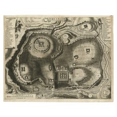
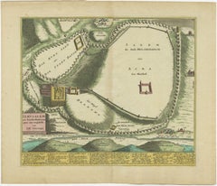
Bird's-Eye Plan of Jerusalem in Israël, a Rare Original Engraving, 1750

$888.47
£657.30
€750VAT Included
CA$1,229.69
A$1,234.16
CHF 719.68
MX$15,003.78
NOK 8,269.80
SEK 8,505.06
DKK 5,718.29

About the Item

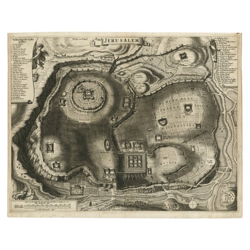
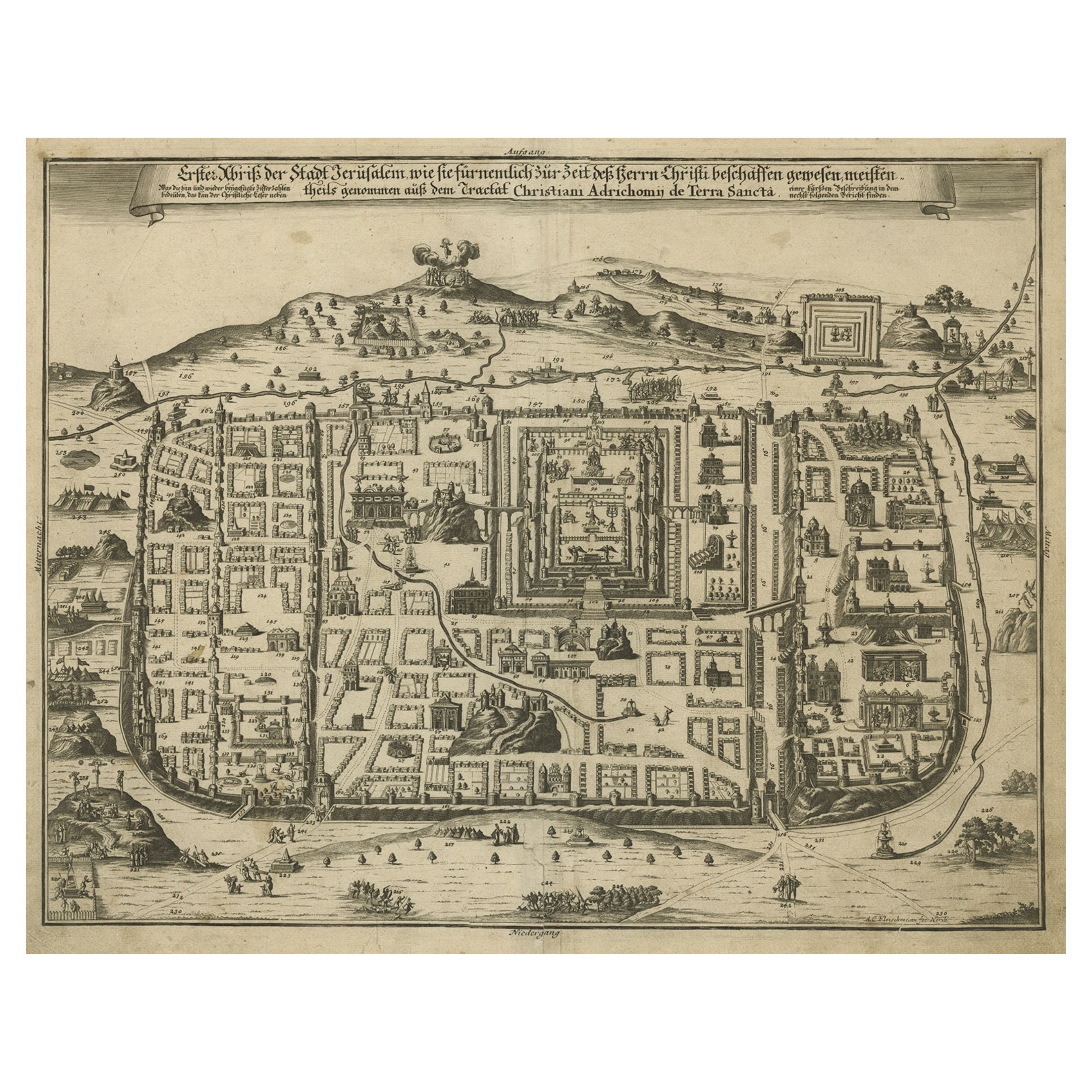
Antique map titled 'De VIIde Landkaart Verbeeldende de Stad Jerusalem Beneven de daar Omgelegen Bergen en Dalen (..).' Bird's-eye plan of Jerusalem in Israel. This map shows the most important buildings and locations, including the City of David, Golgatha, and the Temple of Mount Moriah. Publisehd by A. van Paddenburg, Netherlands,1750. Artists and Engravers: Made by 'F. de Bakker' after 'Willem Bachiene'. Author: Willem Albert Bachiene (Leerdam 1712 - Maastricht 1783). He was a Clergyman in the army and in Namen, Belgium and Kuilenburg (Culemborg). From 1759 he was Clergyman in Maastricht and also Professor in Astronomy and Geography at the 'Illustere School'. Artist: Made by 'F. de Bakker' after 'Willem Bachiene'. Author: Willem Albert Bachiene (Leerdam 1712 - Maastricht 1783). He was a Clergyman in the army and in Namen, Belgium and Kuilenburg (Culemborg). From 1759 he was Clergyman in Maastricht and also Professor in Astronomy and Geography at the 'Illustere School'. Condition: Good, given age. Slight discolouration near middle fold. Original middle fold as issued. General age-related toning and/or occasional minor defects from handling. Please study image carefully. Date: 1750 Overall size: 48.7 x 39.6 cm. Image size: 40.8 x 32.7 cm.
  • Dimensions:
    Height: 19.18 in (48.7 cm)Width: 15.6 in (39.6 cm)Depth: 0 in (0.01 mm)
  • Materials and Techniques:
  • Period:
  • Date of Manufacture:
    1750
  • Condition:
    Condition: Good, given age. Slight discolouration near middle fold. Original middle fold as issued. General age-related toning and/or occasional minor defects from handling. Please study image carefully.
  • Seller Location:
    Langweer, NL
  • Reference Number:
    Seller: PCT-614521stDibs: LU3054326362192

More From This Seller

View All
Antique Detailed Map of Jerusalem in Israël with Extensive Key and Scale, 1698

Antique Detailed Map of Jerusalem in Israël with Extensive Key and Scale, 1698

Located in Langweer, NL

Antique map titled 'Jerusalem.' Plan of the ancient city of Jerusalem. With extensive key and scale. Source unknown, to be determined. Artists and Engravers: Made by 'Cornelis de...

Category

Antique 17th Century Dutch Maps

Materials

Paper

Bird's Eye Plan of the Ancient City of Jerusalem Based on Old Records, c.1725

Bird's Eye Plan of the Ancient City of Jerusalem Based on Old Records, c.1725

Located in Langweer, NL

Antique map titled 'Beschryving van het oude Jeruzalem volgens Villalpandus.' Bird's eye plan of the ancient city of Jerusalem based on Villalpando's foundation map. The plan shows...

Category

Antique Early 18th Century French Maps

Materials

Paper

1720 Weigel Engraving of Jerusalem: A Biblical View from Josephus' Perspective

1720 Weigel Engraving of Jerusalem: A Biblical View from Josephus' Perspective

Located in Langweer, NL

1720 Weigel Map of Jerusalem Based on Josephus' Writings This intricate 1720 bird's-eye view map of ancient Jerusalem by I.H. Coccejo, engraved by Christoph Weigel, offers a fasc...

Category

Antique 1720s Maps

Materials

Paper

Antique Bible Plan of Jerusalem by Covens & Mortier, 1743

Antique Bible Plan of Jerusalem by Covens & Mortier, 1743

Located in Langweer, NL

This plan originates from ‘Biblia Sacra, dat is, de H. Schriftuer van het Oude, en het Nieuwe Testament, naer de laetste Roomsche keure der gemeine Latijnsche overzettinge, in nederd...

Category

Antique Mid-18th Century Maps

Materials

Paper

Plan of Ancient Jerusalem – Cornelis de Bruijn’s Engraved City View c.1698

Plan of Ancient Jerusalem – Cornelis de Bruijn’s Engraved City View c.1698

Located in Langweer, NL

Plan of Ancient Jerusalem – Cornelis de Bruijn’s Engraved City View c.1698 This antique map titled Jerusalem is an intricate plan of the ancient city, richly detailed and marked wit...

Category

Antique Late 17th Century Dutch Prints

Materials

Paper

You May Also Like

18th Century Engraving "Birdseye View of New Park in Surrey" c.1724

18th Century Engraving "Birdseye View of New Park in Surrey" c.1724

Located in San Francisco, CA

18th Century Engraving "Birdseye View of New Park in Surrey" c.1724 Bird's eye view of the the New Park in Surrey, the Seat of the Honorable Earle of Rochester From the 1724 editio...

Category

Early 18th Century Landscape Prints

Materials

Etching

18th Century Engraving "Birdseye View of Grand Country House at Hamstead Marshal

18th Century Engraving "Birdseye View of Grand Country House at Hamstead Marshal

Located in San Francisco, CA

18th Century Engraving "Birdseye View of Grand Country House at Hamstead Marshall" C.1924 Bird's eye view of the grand country house and gardens at Hamstead Marshall in Berkshire, o...

Category

Early 18th Century Landscape Prints

Materials

Etching

Plan of the Park, Garden and Plantations of Goodwood, 18th century engraving

Plan of the Park, Garden and Plantations of Goodwood, 18th century engraving

By Colen Campbell

Located in Melbourne, Victoria

Plan of the Park, Garden and Plantations of Goodwood in Sussex the Seat of his Grace the Duke of Richmond and Lenox &c Copper-line engraving with later hand-colouring by Hendrik Hul...

Category

18th Century English School Landscape Prints

Materials

Engraving

1748 Map of Richmond Upon Thames by John Roque

1748 Map of Richmond Upon Thames by John Roque

Located in Gloucestershire, GB

A 1748 map of Richmond-Upon-Thames by famed surveyor and cartographer, John Roque. Placed in a simple black and gilt frame. The map is in fair condition but there are small sections ...

Category

Antique Mid-18th Century English Maps

Materials

Wood, Paper

17th Century Toulouse, Savve, Sommieres Topographical Map by Iohan Peeters

17th Century Toulouse, Savve, Sommieres Topographical Map by Iohan Peeters

Located in New York, NY

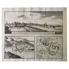
Fine topographical 17th century map of Toulouse, Savve and Sommieres by Iohan Peeters Beautiful engraving of the capital of France's Occitanie Region, Toulouse, called La Ville Rose- the Pink City, for the terracotta bricks used in its many buildings, giving the city a distinct apricot-rose hue. An important cultural and educational center, the city's residents included Nobel Prize winners and world renown artists- Henri de Toulouse-Lautrec, Henri Martin, Jean-Auguste-Dominique Ingres, Antonin Mercie, Alexandre Falguiere and more recently Cyril Kongo...

Category

Antique 17th Century Dutch Maps

Materials

Paper

18th Century French Map and City View of Joppe/Jaffa (Tel Aviv) by Sanson

18th Century French Map and City View of Joppe/Jaffa (Tel Aviv) by Sanson

By Nicholas Sanson d'Abbeville

Located in Alamo, CA

An original antique engraving entitled "Joppe; in ’t Hebreeusch by ouds Japho; hedendaags Japha, of Jaffa; volgens d’aftekening gedaan 1668", by Nicholas Sanson d'Abbeville (1600 - 1667). This is a view of the city of Joppe (in Hebrew Japho), now called Japha or Jaffa, the harbor portion of modern day Tel Aviv, Israel as it appeared in 1668 . It depicts a very busy harbor with numerous boats. A large ship on the left appears to be firing its canons and a small ship on the right appears to be sitting very low in the water, either heavily loaded with cargo or sinking. The town is seen on the far shore with a fortress on a hill across in the background. The map is printed from the original Sanson copperplate and was published in 1709 by his descendants. The map is presented in an ornate brown wood frame embellished by gold-colored leaves and gold inner trim with a double mat; the outer mat is cream-colored and the inner mat is black. There is a central vertical fold, as issued. There are two small spots in the lower margin and one in the upper margin, as well as two tiny spots adjacent to the central fold. 1717 is written below the date 1668 in the inscription. The map is otherwise in very good condition. Another map of the "Holy Land" (by Claes Visscher in 1663), with an identical style frame and mat is available. This pair of maps would make a wonderful display grouping. Please see Reference #LU117324709892. Artist: Nicholas Sanson d'Abbeville (1600 - 1667) and his descendents were important French cartographer's active through the 17th century. Sanson started his career as a historian and initially utilized cartography to illustrate his historical treatises. His maps came to the attention of Cardinal Richelieu and then King Louis XIII of France, who became a supporter and sponsor. He subsequently appointed Sanson 'Geographe Ordinaire du Roi' the official map maker to the king. Sanson not only created maps for the king, but advised him on geographical issues and curated his map collection...

Category

Early 1700s Prints and Multiples
Materials

Engraving