Want more images or videos?
Request additional images or videos from the seller
1 of 5

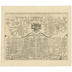
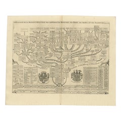
Antique Genealogy Chart of the Landgraviate Hessen-Kassel, Germany, 1732

$245.71
$307.1420% Off
£181.51
£226.8820% Off
€208VAT Included
€26020% Off
CA$341.13
CA$426.4120% Off
A$347.40
A$434.2520% Off
CHF 199.42
CHF 249.2820% Off
MX$4,192.05
MX$5,240.0620% Off
NOK 2,311.23
NOK 2,889.0320% Off
SEK 2,342.97
SEK 2,928.7220% Off
DKK 1,586.20
DKK 1,982.7520% Off

About the Item

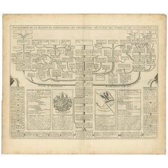
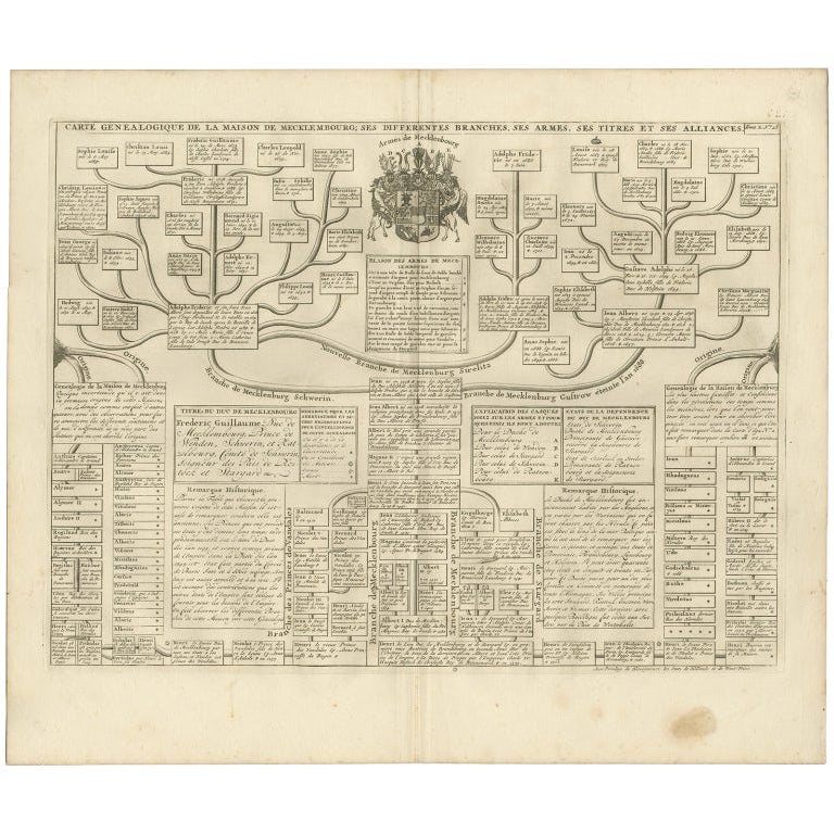
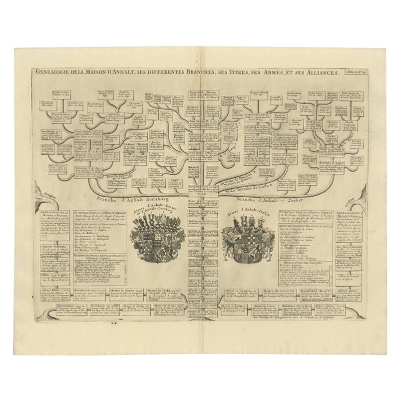
Antique print titled 'Genealogie de la Maison de Hesse Cassel'. Chart of the genealogy of the Landgraviate Hessen-Kassel / Hesse-Cassel. This includes the coats of arms of both Hesse-Cassel and Hesse-Darmstadt. This print orginates from 'Atlas Historique'. The Landgraviate of Hesse-Kassel (German: Landgrafschaft Hessen-Kassel), spelled Hesse-Cassel during its entire existence, was a state in the Holy Roman Empire that was directly subject to the Emperor. The state was created in 1567 when the Landgraviate of Hesse was divided upon the death of Philip I, Landgrave of Hesse. His eldest son William IV inherited the northern half of the Landgraviate and the capital of Kassel. The other sons received the Landgraviate of Hesse-Marburg, the Landgraviate of Hesse-Rheinfels and the Landgraviate of Hesse-Darmstadt. During the Napoleonic reorganisation of the Empire in 1803, the Landgrave of Hesse-Kassel was elevated to an Electorate and Landgrave William IX became an Imperial Elector. Many members of the Hesse-Kassel House served in the Danish military gaining high ranks and power in the Oldenburg realm due to the fact that many Landgraves were married to Danish princesses. Members of the family who are known to have served Denmark-Norway include Prince Frederik of Hesse-Kassel, Prince Frederick of Hesse-Kassel, and Prince Charles of Hesse-Kassel. It was later occupied by French troops and became part of the Kingdom of Westphalia, a French satellite state. The Electorate of Hesse was restored at the end of the Napoleonic Wars, though by that time there was no longer an emperor to elect. Artists and Engravers: Henri Abraham Chatelain (1684-1743), his father Zacharie Chatelain (d.1723) and Zacharie Junior (1690-1754), worked as a partnership publishing the Atlas Historique. Condition: Very good, general age-related toning. Please study image carefully. Date: 1732 Overall size: 51.6 x 43.2 cm. Image size: 45.6 x 34.1 cm. We also offer thousands of antique prints covering fields of interest as diverse as architecture, natural history, religion, ethnology and many more. Antique prints have long been appreciated for both their aesthetic and investment value. They were the product of engraved, etched or lithographed plates. These plates were handmade out of wood or metal, which required an incredible level of skill, patience and craftsmanship. Whether you have a house with Victorian furniture or more contemporary decor an old engraving can enhance your living space.
  • Dimensions:
    Height: 17.01 in (43.2 cm)Width: 20.32 in (51.6 cm)Depth: 0 in (0.01 mm)
  • Materials and Techniques:
  • Period:
  • Date of Manufacture:
    1732
  • Condition:
  • Seller Location:
    Langweer, NL
  • Reference Number:
    Seller: BG-019451stDibs: LU3054325964972

More From This Seller

View All
Antique Genealogy Chart of the Margraviates and Baden-Durlach, Germany, 1732

Antique Genealogy Chart of the Margraviates and Baden-Durlach, Germany, 1732

Located in Langweer, NL

Antique print titled 'Genealogie de la Maison de Baden (..)'. Chart of the genealogy of the Margraviates Baden-Baden and Baden-Durlach. This print orginates from 'Atlas Historique'. ...

Category

Antique 18th Century Prints

Materials

Paper
Old Genealogy Chart of the Rulers of Margraviate Brandenburg in Germany, 1732

Old Genealogy Chart of the Rulers of Margraviate Brandenburg in Germany, 1732

Located in Langweer, NL

Antique print titled 'Genealogie de la Maison de Brandebourg (..)'. Genealogy of the rulers of the Margraviate Brandenburg. This print orginates from 'Atlas Historique'. The Margraviate of Brandenburg (German: Markgrafschaft Brandenburg) was a major principality of the Holy Roman Empire from 1157 to 1806 that played a pivotal role in the history of Germany and Central Europe. Brandenburg developed out of the Northern March founded in the territory of the Slavic Wends. It derived one of its names from this inheritance, the March of Brandenburg (Mark Brandenburg). Its ruling margraves were established as prestigious prince-electors in the Golden Bull...

Category

Antique 18th Century French Prints

Materials

Paper

Antique Genealogy Chart of the Duchy of Brunswick-Luneburg, Germany, 1732

Antique Genealogy Chart of the Duchy of Brunswick-Luneburg, Germany, 1732

Located in Langweer, NL

Antique print titled 'Carte Genealogique de la Maison de Brunsuick-Lunebourg'. Genealogy of the Duchy of Brunswick-Luneburg. With coats of arms of the Elector of Hannover and the Duc...

Category

Antique 18th Century Prints

Materials

Paper
Antique Genealogy Chart of the House of Holstein, 1732

Antique Genealogy Chart of the House of Holstein, 1732

Located in Langweer, NL

Antique print titled 'Carte Genealogique d'Holstein (..)'. Genealogical chart of the house Holstein. Shows both the ducal and the royal arms of the House (the ducal arms with keyed l...

Category

Antique 18th Century Prints

Materials

Paper
Antique Genealogy Chart of the House of Wurttemberg in Germany, 1732

Antique Genealogy Chart of the House of Wurttemberg in Germany, 1732

Located in Langweer, NL

Antique print titled 'Genealogie de la Maison de Wirtemberg (..)'. Genealogy of the House Wurttemberg. This print orginates from 'Atlas Historique'. The House of Württemberg is a...

Category

Antique 18th Century Prints

Materials

Paper
You May Also Like

18thC French Coloured Chronological Chart Of The World Empires/Republics c.1774

18thC French Coloured Chronological Chart Of The World Empires/Republics c.1774

Located in Royal Tunbridge Wells, Kent

A rare and intellectually fascinating 18th Century French hand-coloured chronological chart titled “Chronologie Figurée pour l'Intelligence de l'Histoire des Révolutions des Empires ...

Category

Antique 18th Century French Other Drawings

Materials

Paper

18th-century Antique Map of Austria and Slovenia

18th-century Antique Map of Austria and Slovenia

By Christoph Weigel

Located in Wilton Manors, FL

Christoph Weigel (1654-1725) Map of Austria and Slovenia, 1719. Hand-colored engraving on laid paper. Plate measures 15.25 x 12.75 inches. Framed measurement: 19 x 21 inches. Jo...

Category

1710s Landscape Prints

Materials

Engraving

Mid-18th Century Hand Drawn English Farm Map on Vellum, circa 1740s

Mid-18th Century Hand Drawn English Farm Map on Vellum, circa 1740s

Located in San Francisco, CA

Mid-18th century hand drawn English farm map on Vellum circa 1740s Henry Maxted & Isaac Terry, Surveyors. A Map of a Farm in the Parish of Blean in the County of KENT: Belonging to Mrs Elizabeth Hodgson circa 1743. A beautiful hand drawn map...

Category

Antique Mid-18th Century English Maps

Materials

Lambskin

1657 Janssonius Map of Vermandois and Cappelle, Ric. A-004

1657 Janssonius Map of Vermandois and Cappelle, Ric. A-004

Located in Norton, MA

1657 Janssonius map of Vermandois and Cappelle Ric.a004 Description: Antique map of France titled 'Descriptio Veromanduorum - Gouvernement de la Cappelle'. Two detailed maps o...

Category

Antique 17th Century Unknown Maps

Materials

Paper

18th Century Hand-Colored Homann Map of Germany, Including Frankfurt and Berlin

18th Century Hand-Colored Homann Map of Germany, Including Frankfurt and Berlin

By Johann Baptist Homann

Located in Alamo, CA

An 18th century hand-colored map entitled "Tabula Marchionatus Brandenburgici et Ducatus Pomeraniae quae sunt Pars Septentrionalis Circuli Saxoniae Superioris" by Johann Baptist Homa...

Category

Antique Early 18th Century German Maps

Materials

Paper