Want more images or videos?
Request additional images or videos from the seller
1 of 11

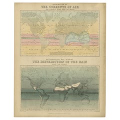
Rain and Snow Map by A.K. Johnston – Global Precipitation Chart 1852

$306.27per item
£227.53per item
€260per itemVAT Included
CA$429.20per item
A$434.58per item
CHF 247.23per item
MX$5,281.47per item
NOK 2,922.38per item
SEK 2,907.02per item
DKK 1,982.43per item
Quantity

About the Item

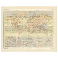
Rain and Snow Map by A.K. Johnston – Global Precipitation Chart 1852 This antique meteorological chart titled "The Distribution of Rain and Snow over the Globe" was created by Alexander Keith Johnston and published in 1852 by William Blackwood & Sons in Edinburgh and London. It is Plate 14 from Johnston’s groundbreaking *Physical Atlas of Natural Phenomena*, a landmark 19th-century atlas that visually documented natural science using elegant cartographic design. This thematic map represents one of the earliest global attempts to chart patterns of precipitation, displaying how rainfall and snowfall vary according to geography, latitude, topography, and proximity to oceans. The map divides the world into meteorological zones based on the frequency and regularity of rainfall. Shaded bands mark areas of constant equatorial rainfall, seasonal monsoon regions, zones of periodic tropical downpours, and drier arid zones such as the Sahara, Arabian Peninsula, central Australia, and western South America. The map is annotated with explanatory observations, including statements such as “rains fall only at night and early morning” and “rains accompany heat and decrease with altitude,” reflecting the 19th-century state of meteorological knowledge. Areas with snowfall or extremely low precipitation are also marked, highlighting the climatological variety across continents. In addition to the main map, the plate includes three detailed diagrams: * A vertical section comparing snow-line elevations across different mountain ranges worldwide. * A graph illustrating the relationship between precipitation and temperature. * A chart showing how rainfall decreases with increasing distance from coastal regions. Johnston (1804–1871), Geographer in Ordinary to Queen Victoria in Scotland, was among the first to bring natural science into the visual domain through cartography. His *Physical Atlas* is considered one of the most influential works of 19th-century thematic mapping, and this plate is a remarkable example of its ambition and execution. This print offers collectors and scholars a glimpse into early meteorological theory and global climatology. Its elegant engraving and carefully hand-colored zones also make it an attractive decorative item for libraries, offices, and scientific interiors. Condition and framing tips: Good condition with light toning and mild signs of age near the edges. Printed surface clean and crisp. Best framed in dark wood or matte black with a neutral or parchment mat to bring out the warm tonal shading of the climatic zones. A refined and thought-provoking piece for any natural science or vintage cartography collection.
  • Dimensions:
    Height: 10.79 in (27.4 cm)Width: 13.59 in (34.5 cm)Depth: 0.01 in (0.2 mm)
  • Materials and Techniques:
  • Place of Origin:
  • Period:
  • Date of Manufacture:
    1852
  • Condition:
    Very good condition. Light overall toning near the margins. The paper remains strong and well-preserved. Folding line as issued.
  • Seller Location:
    Langweer, NL
  • Reference Number:
    Seller: BG-13207-141stDibs: LU3054345393472

More From This Seller

View All
Antique Rain Map of the World by Johnston '1850'

Antique Rain Map of the World by Johnston '1850'

Located in Langweer, NL

Antique map titled 'Hyetographic or Rain Map of the World'. Original antique rain map of the world. This map originates from 'The Physical Atlas of Natural Phenomena' by A.K. Johnsto...

Category

Antique Mid-19th Century Maps

Materials

Paper
Climatological Map by A.K. Johnston – Global Temperatures Chart 1852

Climatological Map by A.K. Johnston – Global Temperatures Chart 1852

Located in Langweer, NL

Climatological Map by A.K. Johnston – Global Temperatures Chart 1852 This exceptional antique map titled "Climatological Chart Showing by Lines & Figures the Mean Annual Temperature...

Category

Antique Mid-19th Century Scottish Prints

Materials

Paper

Antique Map of the Distribution of Air and Rain by Reynolds, 1843

Antique Map of the Distribution of Air and Rain by Reynolds, 1843

Located in Langweer, NL

Two antique world maps on one sheet. The upper map shows the distribution of the currents of air and variable winds over the world. The lower meteorological map shows the distributio...

Category

Antique 19th Century Maps

Materials

Paper

Wind and Hurricane Map by A.K. Johnston – Meteorological Chart 1852

Wind and Hurricane Map by A.K. Johnston – Meteorological Chart 1852

Located in Langweer, NL

Wind and Hurricane Map by A.K. Johnston – Meteorological Chart 1852 This scientifically significant 1852 map titled "The Distribution of the Constant, Periodical & Variable Winds Ov...

Category

Antique Mid-19th Century Scottish Prints

Materials

Paper

Antique Rain Map of Europe by Johnston '1850'

Antique Rain Map of Europe by Johnston '1850'

Located in Langweer, NL

Antique map titled 'Hyetographic or Rain Map of Europe'. Original antique rain map of Europe. This map originates from 'The Physical Atlas of Natural Phenomena' by A.K. Johnston, pub...

Category

Antique Mid-19th Century Maps

Materials

Paper
You May Also Like

Map of the World - Original Etching - 1820

Map of the World - Original Etching - 1820

Located in Roma, IT

Map of the World is an Original Etching realized by an unknown artist of 19th century in 1820. Very good condition on two sheets of white paper joine...

Category

1820s Modern Figurative Prints

Materials

Etching

Original Antique Map of The World by Thomas Clerk, 1817

Original Antique Map of The World by Thomas Clerk, 1817

Located in St Annes, Lancashire

Great map of The Eastern and Western Hemispheres On 2 sheets Copper-plate engraving Drawn and engraved by Thomas Clerk, Edinburgh. Published by Mackenzie And Dent, 1817 ...

Category

Antique 1810s English Maps

Materials

Paper

1850 Old French Map Depicting the Entire Earth's Surface Divided into Two Parts

1850 Old French Map Depicting the Entire Earth's Surface Divided into Two Parts

Located in Milan, IT

Geographical map depicting the entire earth's surface divided into two parts that correspond to the two hemispheres where the emerged lands are depicted which have been classified wi...

Category

Antique Mid-19th Century French Maps

Materials

Glass, Wood, Paper

Hemisphere Of The New Continent - Ancient Map by J.G. Heck - 1834.

Hemisphere Of The New Continent - Ancient Map by J.G. Heck - 1834.

By Johann Georg Heck

Located in Roma, IT

Hemisphere Of The New Continent is an artwork realized around 1760 by Johann Georg Heck Original colored print. Good conditions except for yellowing of paper and tears along the m...

Category

1830s Modern Figurative Prints

Materials

Etching

1864 Original illustrated planisphere - World Map - Geography

1864 Original illustrated planisphere - World Map - Geography

Located in PARIS, FR

Immerse yourself in the epic journey of the past with the Illustrated Historical Planisphere of 1864 by Charpentier! 🗺️ This cartographic treasure transports you through the intrica...

Category

1860s Prints and Multiples

Materials

Linen, Paper, Lithograph

Large Original Antique Map of The World, Fullarton, C.1870

Large Original Antique Map of The World, Fullarton, C.1870

Located in St Annes, Lancashire

Great map of the World. Showing both hemispheres From the celebrated Royal Illustrated Atlas Lithograph. Original color. Published by Fullarton, Edinburgh, C.1870 Unframed. Rep...

Category

Antique 1870s Scottish Maps

Materials

Paper