Want more images or videos?
Request additional images or videos from the seller
1 of 11

Suriname & the Dutch Antilles – Colonial Atlas Map by W.J. Thieme, c.1905

$283.22
£209.30
€240VAT Included
CA$393.01
A$400.14
CHF 230.45
MX$4,821.42
NOK 2,674.34
SEK 2,698.25
DKK 1,829.78

About the Item

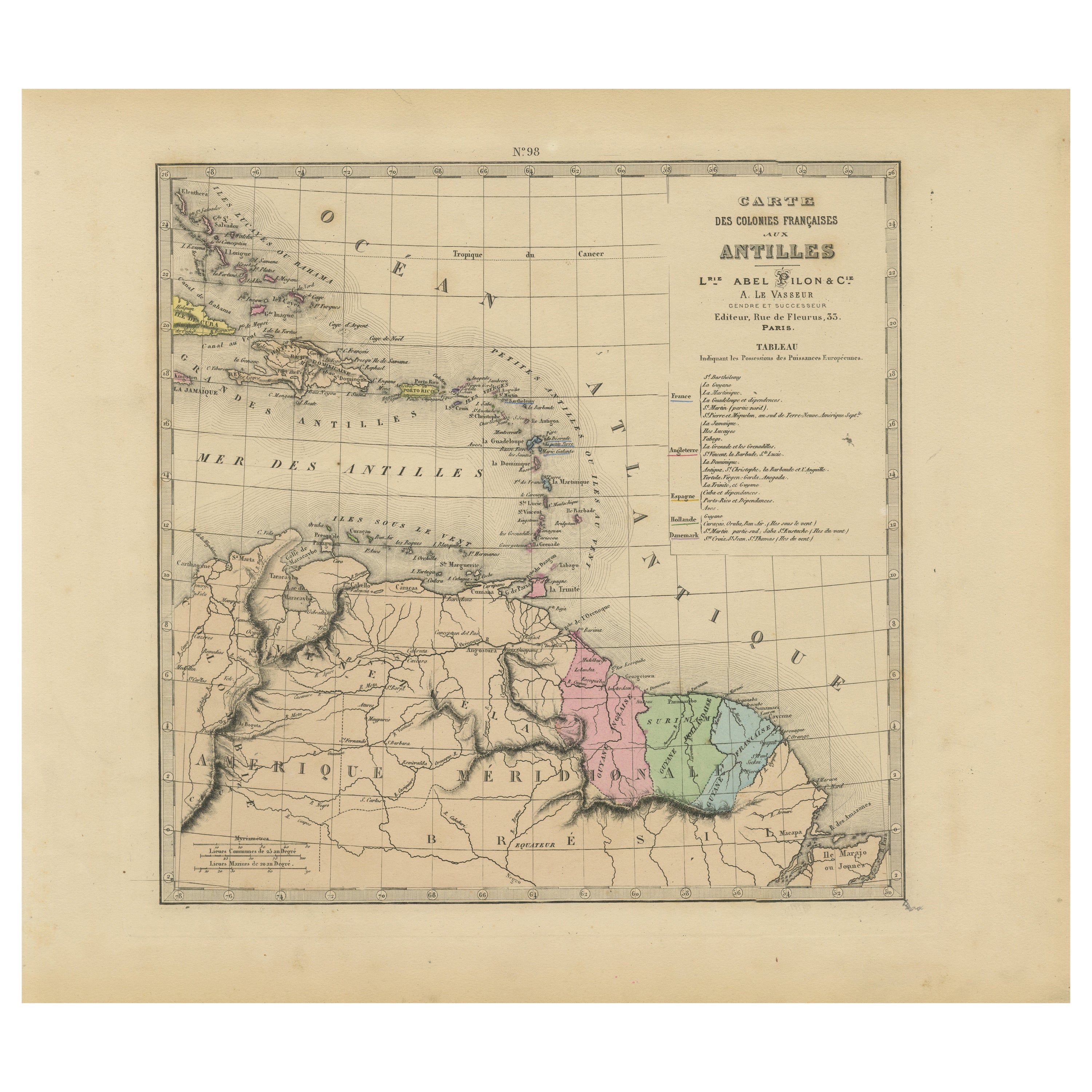
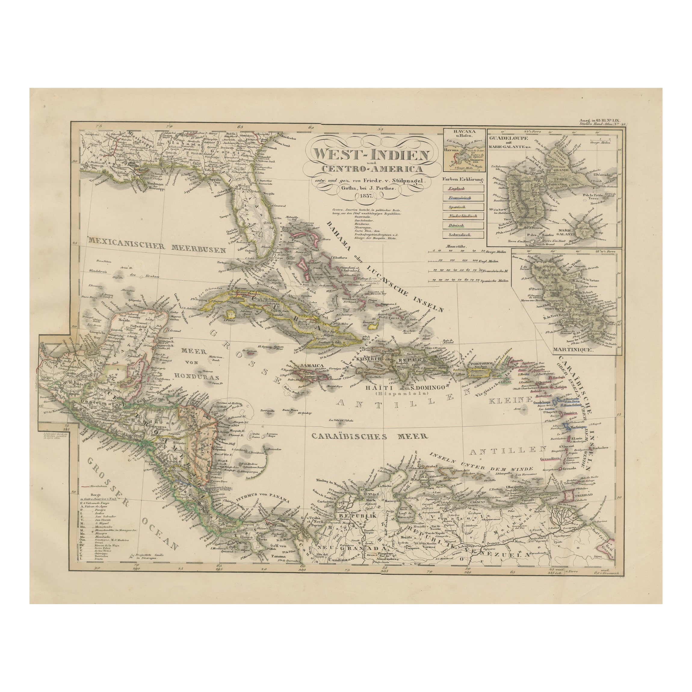
Suriname & the Dutch Antilles – Colonial Atlas Map by W.J. Thieme, c.1905 This highly detailed antique Dutch colonial atlas map depicts Suriname together with the Dutch possessions in the Caribbean, including Curaçao, Aruba, Bonaire, St. Martin, Saba, and St. Eustatius. Published circa 1905 by the respected Dutch publisher W.J. Thieme & Co. of Zutphen, the map reflects the geography and administrative structure of the Dutch colonial empire in the Americas during the early 20th century. The large central map focuses on Suriname in exceptional detail, showing rivers, mountain ranges, forests, settlements, indigenous territories, and colonial administrative regions extending far into the interior. The extensive river systems dominate the composition and illustrate the critical importance of waterways for transportation, plantation agriculture, and colonial expansion. Several inset maps provide additional geographic context: * the Dutch Caribbean islands including Curaçao, Aruba, and Bonaire, * the Dutch Antilles, * and a broader overview locating the Dutch colonies within northern South America and the Caribbean basin. Printed in a refined educational cartographic style with delicate original outline coloring, the map combines scientific clarity with decorative appeal. The soft pastel palette and balanced multi-map composition make it particularly attractive when framed. W.J. Thieme & Co. was one of the leading Dutch educational publishers of the late 19th and early 20th centuries, producing high-quality school atlases and geographical works widely used throughout the Netherlands. Maps such as this served both educational and administrative purposes during the height of Dutch overseas colonial influence. Today, maps of Suriname and the Dutch Caribbean remain highly sought after for their historical significance, decorative quality, and connection to colonial history, migration, maritime trade, and the cultural heritage of the Dutch Atlantic world. Special note: This is an original antique atlas map, not a reproduction. All items we offer are authentic period works of art over 100 years old. The map is sold unframed; any framed images are shown for presentation and interior inspiration only and may not always be to scale with the original. Condition report: Overall in good antique condition with age-related toning and minor handling wear consistent with early 20th-century atlas maps. Original fold lines as issued. Some light foxing and marginal wear visible. Original outline coloring remains attractive and well preserved. Please study the image carefully. Framing tips: This map displays beautifully in dark walnut, black lacquer, or lightly gilt frames paired with wide ivory mats. Its combination of Caribbean and South American colonial geography makes it especially suitable for libraries, studies, maritime interiors, or collections focused on Dutch colonial history. Technique: Color lithographic atlas map Maker: W.J. Thieme & Co., Zutphen, circa 1905
  • Dimensions:
    Height: 13.31 in (33.8 cm)Width: 18.15 in (46.1 cm)Depth: 0.01 in (0.2 mm)
  • Materials and Techniques:
  • Place of Origin:
  • Period:
  • Date of Manufacture:
    circa 1905
  • Condition:
    Overall in good antique condition with age-related toning and minor handling wear consistent with early 20th-century atlas maps. Original fold lines as issued. Some light foxing and marginal wear visible. Original outline coloring remains attractive.
  • Seller Location:
    Langweer, NL
  • Reference Number:
    Seller: BG-14293-21stDibs: LU3054350149652

More From This Seller

View All
Suriname, Curaçao & Dutch Guinea – Jacob Kuyper Colonial Atlas Map, 1882

Suriname, Curaçao & Dutch Guinea – Jacob Kuyper Colonial Atlas Map, 1882

Located in Langweer, NL

Suriname, Curaçao & Dutch Guinea – Jacob Kuyper Colonial Atlas Map, 1882 This finely detailed antique Dutch colonial map titled Nederlandsche Bezittingen in West-Indie en ter Kuste ...

Category

Antique Late 19th Century Dutch Prints

Materials

Paper

1880 Map of the Caribbean and Central America by Adolf Stieler

1880 Map of the Caribbean and Central America by Adolf Stieler

Located in Langweer, NL

This is a detailed map titled "West-Indien und Central-Amerika," created by Adolf Stieler and published in Gotha in 1880. The map covers the Caribbean islands and the Central America...

Category

Antique 1880s Maps

Materials

Paper

Authentique Map by Pilon of The French Colonies in The West Indies, 1876

Authentique Map by Pilon of The French Colonies in The West Indies, 1876

Located in Langweer, NL

The 1876 map titled "Carte des Colonies Françaises aux Antilles" represents a significant contribution to cartography within the "Grand Atlas Départemental de la France de L'Algérie ...

Category

Antique Late 19th Century Maps

Materials

Paper

Map of the West India Islands and Central America – Colorful 1903 Engraving

Map of the West India Islands and Central America – Colorful 1903 Engraving

Located in Langweer, NL

Map of the West India Islands and Central America – Colorful 1903 Engraving This vibrant engraved map, titled "West India Islands and Central America," was created by Keith Johnston...

Category

Early 20th Century Maps

Materials

Paper

Antique Map of the Antilles and Central America – 1872

Antique Map of the Antilles and Central America – 1872

Located in Langweer, NL

Title: Antique Map of the Antilles and Central America – 1872 Description: This finely detailed antique map, titled Antilles et Amérique Centrale, was published in 1872 under t...

Category

Antique 1870s Maps

Materials

Paper

Antique Map of the Antilles by Pierre M. Lapie, Mid-19th Century

Antique Map of the Antilles by Pierre M. Lapie, Mid-19th Century

Located in Langweer, NL

Antique map titled 'Carte des Antilles du Golfe du Méxique'. Map of the Antilles. This map originates from 'Atlas universel de géographie ancienne et moderne (..)' by Pierre M. Lapie...

Category

Antique Mid-19th Century French Maps

Materials

Paper

You May Also Like

Original Antique Map of Central America / Florida, Arrowsmith, 1820

Original Antique Map of Central America / Florida, Arrowsmith, 1820

Located in St Annes, Lancashire

Great map of Central America. Drawn under the direction of Arrowsmith. Copper-plate engraving. Published by Longman, Hurst, Rees, Orme and Brown, 1820 Unframed.

Category

Antique 1820s English Maps

Materials

Paper

Large Original Antique Map of The Leeward Islands. 1894

Large Original Antique Map of The Leeward Islands. 1894

Located in St Annes, Lancashire

Superb Antique map of The Leeward Islands Published Edward Stanford, Charing Cross, London 1894 Original colour Good condition Unframed. Free shipping

Category

Antique 1890s English Maps

Materials

Paper

Antique Jamaica Map, English, Caribbean, Cartography, Thomas Jefferys, Georgian

Antique Jamaica Map, English, Caribbean, Cartography, Thomas Jefferys, Georgian

Located in Hele, Devon, GB

This is an antique Jamaica map. An English, framed Caribbean island engraving by Thomas Jefferys, dating to the 18th century and later, dated 1794. Excellent Georgian period cartog...

Category

Antique 1790s British Georgian Maps

Materials

Glass, Paper

Map Of The Island Of Cuba - Guillaume Thomas Raynal (1711-1796)

Map Of The Island Of Cuba - Guillaume Thomas Raynal (1711-1796)

Located in Porto, PT

This historical map of the Island of Cuba was produced in the late 18th century and is taken from an edition of “Atlas de toutes les parties connues du globe terrestre” by the French...

Category

Antique 18th Century Prints

Materials

Glass, Paper

Large Original Antique Map of The Canary Islands. 1894

Large Original Antique Map of The Canary Islands. 1894

Located in St Annes, Lancashire

Superb Antique map of The Canary Islands Published Edward Stanford, Charing Cross, London 1894 Original colour Good condition Unframed. Free shipping

Category

Antique 1890s English Maps

Materials

Paper